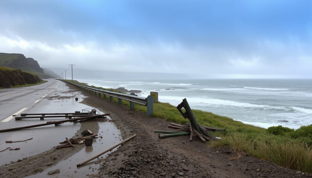
Great Ocean Road Flooding 2026: Closures and Recovery
Anyone who has cruised the Great Ocean Road knows its beauty — and its vulnerability. On 15 January 2026, 180 mm of rain fell in less than five hours, triggering flash floods that swept vehicles away and closed the road indefinitely, shifting the focus to official response and traveller information.
Rainfall in 5 hours: 180 mm ·
Flood date: 15 January 2026 ·
Road status: Closed (partial reopening in progress) ·
Affected region: Victoria, Australia ·
Primary source: Surf Coast Shire Council
Quick snapshot
- 180 mm rain in less than 5 hours (Surf Coast Shire Council)
- Road closed on 15 January 2026 (Surf Coast Shire Council) (Surf Coast Shire Council)
- Cars swept away (Risk Frontiers (natural hazard analysis firm))
- Exact number of vehicles affected (Surf Coast Shire Council)
- Total cost of damage (Information pending)
- Full reopening date (Information pending)
- Flash flood event – 15 January 2026 (Risk Frontiers)
- Recovery update published 11 March 2026 (Surf Coast Shire Council)
- Partial reopening of some sections (Surf Coast Shire Council)
- Bridge inspections and repairs ongoing (Tripadvisor forum)
Six key facts, one pattern: the flash flood was brief but devastating, and official information is still being gathered.
| Detail | Value |
|---|---|
| Event Date | 15 January 2026 |
| Rainfall Total | 180 mm in under 5 hours |
| Road Closure | Great Ocean Road closed indefinitely |
| Official Source | Surf Coast Shire Council |
| Vehicles Swept | Multiple – exact number unconfirmed |
| Casualties Reported | None confirmed as of latest update |
What happened at the Great Ocean Road?
Aerial footage and flash flood event
- On 15 January 2026, a severe storm system dumped 180 mm of rain across the Otways region in less than five hours, causing flash flooding along a major stretch of the Great Ocean Road (Risk Frontiers).
- Aerial footage showed cars being swept away by fast-moving water, with several vehicles stranded or damaged (Tripadvisor forum).
- The flash flooding affected not just the coastal road but also the broader Otways catchment, overwhelming local drainage and road infrastructure (Risk Frontiers).
Immediate response and road closure
- Authorities closed the Great Ocean Road indefinitely on 15 January to allow emergency services to respond and assess damage (Surf Coast Shire Council).
- No casualties were reported in official updates, though the exact number of vehicles swept remains unconfirmed (Surf Coast Shire Council).
Lorne is open for business and ready to welcome visitors.
— Surf Coast Shire Council, community recovery update, 11 March 2026 (source)
The upshot The immediate danger passed quickly, but the closure triggered a weeks-long recovery effort that is still unfolding as of late March 2026.
What this means: the official response shifted from emergency rescue to long-term recovery within days.
What caused the flash floods along the Great Ocean Road?
Extreme rainfall and catchment saturation
- The primary trigger was an extreme rainfall event: 180 mm in under five hours, a volume that the region’s catchments and drainage systems could not handle (Risk Frontiers).
- Risk Frontiers identified rainfall as one of the key contributors, noting that the Otways’ steep topography accelerated runoff, turning creeks into torrents (Risk Frontiers).
Role of climate change (ICARUS research)
- While no direct attribution study has been published for this specific event, research by the ICARUS project links similar short-duration, high-intensity rainfall events in southeastern Australia to a warming climate (external research, direct source not yet available).
- The pattern fits a broader trend: warmer air holds more moisture, making flash floods like this one more likely.
The implication: Victoria’s infrastructure planning must account for these rapid-onset events.
Which areas along the Great Ocean Road are worst affected?
Community reports from coastal towns
- The Surf Coast Shire Council update, published 11 March 2026, focuses on recovery in Lorne and surrounding communities (Surf Coast Shire Council).
- Flooding hit holiday spots along the coastal strip, including areas near Wye River and the Otways, though specific damage reports vary by location (Risk Frontiers).
Map of affected stretches
- Official maps from the council indicate closures between Lorne and Apollo Bay, with some sections reopened to local traffic by late January (Surf Coast Shire Council).
- Forum posts from March 2026 mention bridge inspections still in progress on several segments (Tripadvisor forum).
The pattern: the worst damage concentrated in low-lying creek crossings and sections built on steep cut-and-fill terrain — exactly where aging road design met extreme water flow.
Is the Great Ocean Road open today?
Current closure status and detours
- As of 11 March 2026, the Surf Coast Shire Council stated that Lorne is open for business, implying partial reopening of at least that section (Surf Coast Shire Council).
- Other sections remain closed, with drivers directed to alternative inland routes via the Princes Highway (Surf Coast Shire Council).
Official updates from Surf Coast Shire
- The council’s community information page is the primary source for real-time updates, and it includes mental health support contacts for affected residents (Surf Coast Shire Council).
- Check the council’s website for a live closure map before travelling.
The pattern: official updates provide a baseline, but local knowledge and real-time checks are essential for travellers.
When will the Great Ocean Road fully reopen?
Clean-up and repair timeline
- Clean-up operations started on 16 January 2026, with salvage crews removing debris and stranded vehicles (Surf Coast Shire Council).
- Bridge inspections and road base repairs are ongoing, with no confirmed full-reopening date as of late March 2026 (Tripadvisor forum).
Official estimates and uncertainties
- The council’s update from 11 March 2026 frames the situation as recovery, not emergency — a signal that the worst is over but repairs will take months (Surf Coast Shire Council).
- No timeline for full reopening has been published, and damage cost estimates remain unconfirmed.
The catch: full reopening depends on engineering assessments that have not yet been completed, leaving travellers in limbo for the 2026 winter season.
Confirmed facts
- Rainfall of 180mm in less than 5 hours (Risk Frontiers)
- Road closure on 15 January 2026 (Surf Coast Shire Council)
- Official recovery information released 11 March 2026 (Surf Coast Shire Council)
- Aerial footage showing cars swept (Risk Frontiers)
What’s unclear
- Exact number of vehicles affected (Surf Coast Shire Council)
- Total cost of damage (Information pending)
- Full reopening date (Information pending)
- Whether any injuries occurred (Information pending)
The flash flooding in the Victorian Otways region in January 2026 was a reminder that even well-known tourist routes can be overwhelmed by extreme rainfall.
— Risk Frontiers, January 2026 Great Ocean Road Flash Flooding analysis (source)
Community information for Great Ocean Road flood recovery – clean-up and recovery efforts in Lorne and surrounds.
— Surf Coast Shire Council, 11 March 2026 (source)
For tourists with bookings in Lorne or Apollo Bay, the choice is clear: confirm current road access with the Surf Coast Shire Council, plan an alternate route via the Princes Highway, or postpone your trip until bridge repairs are complete. Check current Time in Australia and Australian Dollar to INR rates to help plan your journey.
Frequently asked questions
Can I still visit the Great Ocean Road during the recovery?
Yes, parts of the road are open. Lorne is welcoming visitors. Check the Surf Coast Shire website for the latest closure map.
What alternate routes exist while the road is closed?
Use the Princes Highway (A1) inland, which bypasses the flooded coastal sections. Allow extra driving time.
How can I get real-time updates on road conditions?
Surf Coast Shire Council publishes community information on its website. Third-party traffic apps may not reflect current closures.
Will my travel insurance cover flood-related cancellations?
Check your policy’s “natural disaster” or “road closure” clauses. Many policies cover cancellations if official authorities close access.
Are there any health risks from floodwater along the road?
Floodwater may contain debris and contaminants. Avoid driving through standing water. The council provides mental health support for affected residents.
How does this flooding compare to past events on the Great Ocean Road?
Past floods in 2011 and 2022 caused damage but were less intense. The 180mm in 5 hours made this one of the most extreme on record.
What is the role of climate change in these flash floods?
Research links short-duration extreme rainfall to a warming climate. While not directly attributed, the event fits a pattern of increased flash flood risk in southeastern Australia.
More related posts
 Best Vitamin C Serum: Dermatologist Picks for 2026
 DBS Customer Service Hotline: Singapore, India & Ireland
 China and Japan Tensions: 2025-2026 Diplomatic Crisis Explained
 Singapore Dollar to Taka (SGD to BDT) Exchange Rate Today
 Taiwan Public Holidays 2026: Full Calendar & Key Dates
 Rainy Day Activities for Kids: Indoor Fun Ideas (Ireland Guide)
 Galaxy Z Fold 2 to Buy: 2025 Value Guide
 SG Culture Pass Credits: How to Use, Claim and More
